
ၾၢႆႇ:I-80 Eastshore Fwy.jpg

သႅၼ်းတႃႇတူၺ်းလူင်ႈၼႃႈ: 800 × 576 ၽိၵ်ႉသႄႇလ်. resolutionsတၢင်ႇဢၼ် : 320 × 230 ၽိၵ်ႉသႄႇလ် | 640 × 461 ၽိၵ်ႉသႄႇလ် | 1,024 × 737 ၽိၵ်ႉသႄႇလ် | 1,280 × 922 ၽိၵ်ႉသႄႇလ် | 1,600 × 1,152 ၽိၵ်ႉသႄႇလ် ။
ၾၢႆႇငဝ်ႈတိုၼ်း (1,600 × 1,152 pixels, တၢင်းလဵၵ်ႉတၢင်းယႂ်ႇ ၾၢႆႇ: 304 KB, ယိူင်ႈ MIME: image/jpeg)
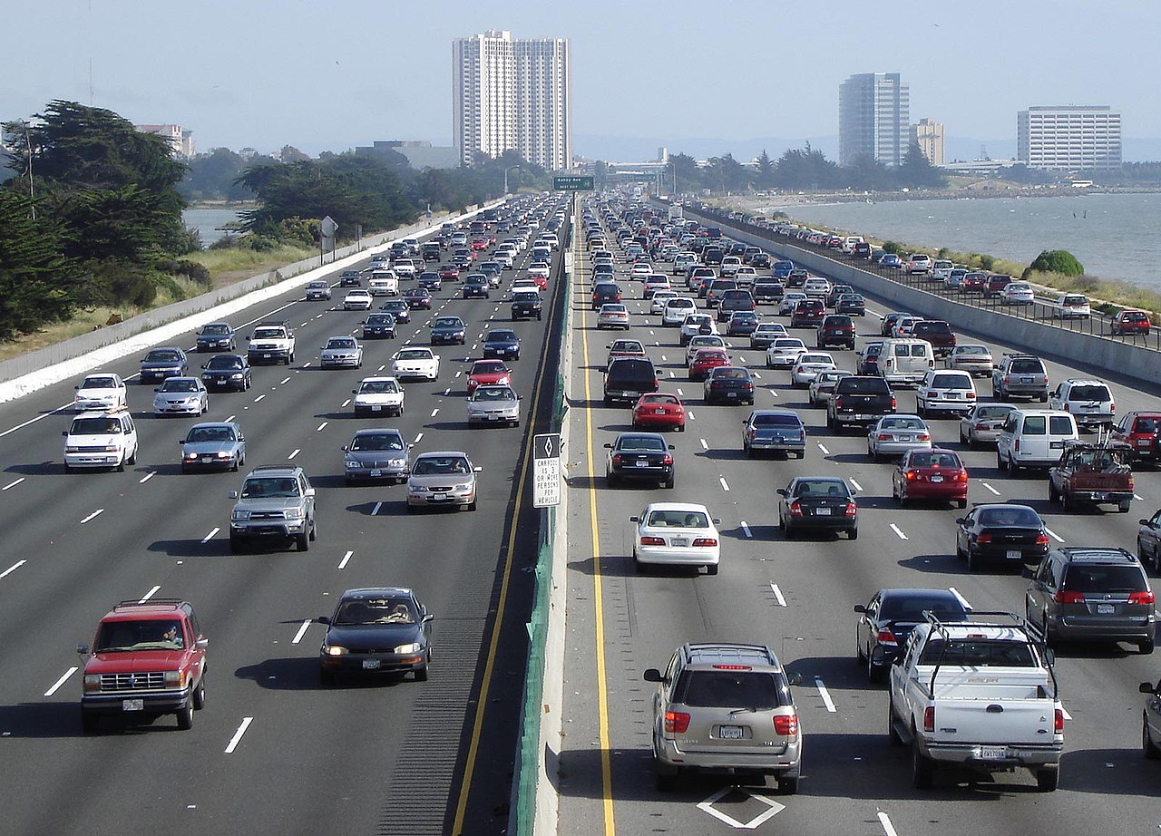
| ၶေႃႈသပ်းလႅင်း | Looking south above en:Interstate 80, the Eastshore Freeway, near en:Berkeley, California on a Saturday afternoon. en:Emeryville, California is at the towers, en:Aquatic Park (Berkeley) is visible to the left. To the right is the east shore of the en:San Francisco Bay. Picture taken by Minesweeper on May 14, 2005. |
| ငိူၼ်ႈငဝ်ႈတိုၼ်း | Minesweeper |
| ၽူႈတႅမ်ႈလိၵ်ႈ | User Minesweeper on en.wikipedia |
| ၶေႃႈလူတ်းပွႆႇ (ၶိုၼ်းၸႂ်ႉ ၾၢႆႇဢၼ်ၼႆႉ) |
Released under the GNU Free Documentation License. |
| Other versions |
Originally from en.wikipedia; description page is (was) here * 10:17, 15 May 2005 [[:en:User:Minesweeper|Minesweeper]] 1600×1152 (311,297 bytes) <span class="comment">(Looking south above Interstate 80, the Eastshore Freeway, near Berkeley, California on a Saturday afternoon. Picture taken by me on May 14, 2005. {{GFDL}})</span> |
| Camera location | | View this and other nearby images on: OpenStreetMap |
|---|

|
ပၼ်ၶႂၢင်ႉ တႃႇတေ ထုတ်ႇဢဝ်၊ ၽႄႈတိုၼ်း လႄႈ/ဢမ်ႇၼၼ် မႄးထတ်း ၼႂ်းလိၵ်ႈၼႆႉ ၸွမ်းၼင်ႇ ၶေႃႈမၼ်ႈၸႂ် GNU Free Documentation License, Version 1.2 ဢမ်ႇၼၼ် ၸိူဝ်းပဵၼ် မၢႆဢွၵ်ႇ ဢၼ်ထုၵ်ႇပိုၼ်ဢွၵ်ႇ ဝၢႆးလင် ၼင်ႇ Free Software Foundation; ဢၼ်ဢမ်ႇမီး လွင်ႈလႅၵ်ႈလၢႆႈ ၵႃႈတီႈ တွၼ်ႈၵၼ်၊ လိၵ်ႈၸိူဝ်းမီးတီႈ ၼႃႈသိုဝ်ႈၽၢႆႈၼႃႈ၊ ၼႃႈသိုဝ်ႈၽၢႆႇလင်။ဢၼ်ပဵၼ် ဝႂ်တႃႇထုတ်ႇဢဝ်ၼႆႉ မၼ်းတေၶဝ်ႈပႃးဝႆႉ ၵႃႈတီႈ တွၼ်ႈၵၼ် ဢၼ်မီးႁူဝ်ၶေႃႈဝႃႈ GNU Free Documentation License ၼၼ်ႉ။ |
| ၾၢႆႇဢၼ်ၼႆႉၼႆႉ မီးသုၼ်ႇဝႂ် ပႃႈတႂ်ႈ ၶွင် Creative Commons Attribution-Share Alike 3.0 Unported ဝႆႉၼႆႉ။ | ||
| ||
| This licensing tag was added to this file as part of the GFDL licensing update. |
(Uploaded using CommonsHelper or PushForCommons)
ပိုၼ်းၾၢႆႇ
တဵၵ်းၼိူဝ် ဝၼ်းထိ/ၶၢဝ်းယၢမ်း တႃႇႁၼ်ၾၢႆႇ ၼႂ်းဝၼ်းၼၼ်ႉ
| ဝၼ်းထီႉ/ၶၢဝ်းယၢမ်း | ႁၢင်ႈလဵၵ်ႉ | သႅၼ်းမၼ်း | ၽူႈၸႂ်ႉတိုဝ်း | တၢင်းႁၼ်ထိုင် | |
|---|---|---|---|---|---|
| ယၢမ်းလဵဝ် | 10:58, 23 ဢွၵ်ႇထူဝ်ႇပႃႇ 2006 | | 1,600 × 1,152 (304 KB) | Zzyzx11 | {{Information| |Description= Looking south above en:Interstate 80, the Eastshore Freeway, near en:Berkeley, California on a Saturday afternoon. Picture taken by Minesweeper on May 14, 2005. |Source= |Date= |Author=User |
လွင်ႈၸႂ်ႉတိုဝ်း ၾၢႆႇ
ၼႃႈလိၵ်ႈ ၵွင်ႉမႃးၸူးၾၢႆႇၼႆႉ:
လွင်ႈၸႂ်ႉတိုဝ်းၾၢႆႇလူမ်ႈၽႃႉ
Wikis ၸိူဝ်းဢၼ်ၸႂ်ႉဝႆႉ ၾၢႆႇဢၼ်ၼႆႉ:
- ၸႂ်ႉဝႆႉ af.wikipedia.org
- ၸႂ်ႉဝႆႉ als.wikipedia.org
- ၸႂ်ႉဝႆႉ ar.wikipedia.org
- ၸႂ်ႉဝႆႉ ar.wiktionary.org
- ၸႂ်ႉဝႆႉ ast.wikipedia.org
- ၸႂ်ႉဝႆႉ az.wikipedia.org
- ၸႂ်ႉဝႆႉ be.wikipedia.org
- ၸႂ်ႉဝႆႉ bg.wikipedia.org
- ၸႂ်ႉဝႆႉ bh.wikipedia.org
- ၸႂ်ႉဝႆႉ bn.wikipedia.org
- ၸႂ်ႉဝႆႉ br.wikipedia.org
- ၸႂ်ႉဝႆႉ bs.wikipedia.org
- ၸႂ်ႉဝႆႉ ca.wikipedia.org
- ၸႂ်ႉဝႆႉ cdo.wikipedia.org
- ၸႂ်ႉဝႆႉ cv.wikipedia.org
- ၸႂ်ႉဝႆႉ cy.wikipedia.org
- ၸႂ်ႉဝႆႉ da.wikipedia.org
- ၸႂ်ႉဝႆႉ de.wikipedia.org
- ၸႂ်ႉဝႆႉ de.wikibooks.org
- ၸႂ်ႉဝႆႉ el.wikipedia.org
- ၸႂ်ႉဝႆႉ en.wikipedia.org
တူၺ်း ၾၢႆႇmore global usage ဢၼ်ၼႆႉ